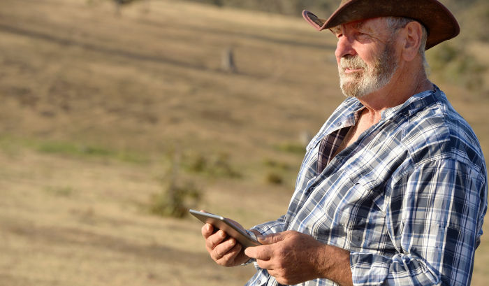
Increasing pressure from commodity returns, input costs and environmental compliance means that farming today relies on consistent, quality decision-making. Good information, viewed properly to gain insights, is the life-blood of great farm decisions.
Unfortunately, the most useful data is often hardest to collect and interpret. Pasture information relies on pasture walks (or drives); stock condition must be assessed manually or using advanced equipment; and even understanding growth rates of cattle or sheep requires pulling them off feed and into yards where the risk of transferring disease increases.
Many advisors from fertiliser and feed planning to finance and animal health now have tools that help with visualising outcomes and supporting decisions. In turn, these tools are also hungry for data – sometimes detailed and sometimes high-level farm information. Some farmers tell me they feel every second person up their driveway needs to ask “twenty questions”.
So how can we satisfy our craving for more and better data, without turning farmers into field technicians or survey gurus?
Start with making better use of the data we have
This might include the farmer’s own records in their tool of choice – whether that’s a feed planning tool, paddock recording system, or their financial management system (which often capture product quantities and inventory as well as sale and purchase records). At the moment this existing data is in silos – unable to be accessed because it is locked away, or perhaps in a different format.
Where forward-looking software vendors have made some data available, it is often unable to be directly applied to answer other questions – at least without a human to interpret. Take the example of one tool asking information about calving dates and peak milking numbers, while another asks for monthly cows in milk. With experience and farm system knowledge, a human can readily translate one from the other – but these inferences are hard to automate.
The Farm Data Standards are the New Zealand industry’s approach to getting a common vocabulary, so that our computer systems will be able to meaningfully re-use data. This vocabulary is supported by the Data Linker (a DairyNZ and Red Meat Profit Partnership project), creating standard protocols so that software tools can share farm data through APIs, with explicit farmer permission. Organisations in the Data Linker early-adopter group are building streamlined processes so farmers can re-use their data with little or no overhead.
Towards more automated collection
The “Internet of Things” (IoT) promises to connect sensors and measurement devices from the farm to farm software and databases, making the most of recent advances in consumer electronics to reduce the cost of the electronics, enhance reliability and improve battery life.
IoT devices now available include remote monitoring and alerts for your water supply, pumps and tanks, as well as devices monitoring the state and efficacy of electric fences and effluent spreaders. There have been electronic solutions in this space for quite some time, but improved mobile and on-farm wireless networks, along with smaller and lower-cost electronics, are now making them more attractive.
Coming IoT devices may monitor water quality in real time, assess pasture cover, assist with matching dams and progeny, or with diagnosing animal health challenges. A key for farmers will be ensuring that they can access this data and re-use it for a wider range of purposes where it makes sense.
Filling in the gaps with remote sensing
Lately I’ve been privileged to meet farmers and technology companies in the United States and Australia, where broad-acre cropping of corn, soybeans, and wheat are the predominant farming practice. Farmers are starting to make great use of multispectral and hyperspectral imagery regularly captured from aircraft, low-earth orbit satellites, and even drones (though the range of most drones is too short for larger farms).
Image analysis from these platforms has been around for a long time now (using normalised vegetation difference index or NVDI, for example), but instead of just displaying images and leaving the farmer to guess what is going on, companies are now applying machine learning to correlate the patterns in the images with known crop issues and yields. For large enterprises, this remote sensing data “fills in the gap” between what the farmer observes by walking in the fields, and the wider enterprise. Hyperspectral imaging that captures additional wavelengths will support more sophisticated analysis, and I look forward to seeing some new crop-specific analyses in the future.
Weather and climate data from MetService and NIWA can also be considered remote sensing data to can support decision making, even for those without their own on-farm weather station. The NIWA Virtual Climate Station Network (VCSN) provides a grid of historic climate data and weather data across New Zealand, and that data is combined with soil drainage and fertility information in the Pasture Growth Forecaster. Other countries provide similar climate data services.
A word to the wise regarding Pasture Growth Forecaster: free regional averages are just that – averages over a broad area and a range of soils. You’ll get better mileage by paying the trivial amount each month to get a custom forecast based on your location and soils.
Bringing it all together
I’ve painted a bright picture of how the data available from a number of sources – existing databases and suppliers or customers, small in-field devices connected with the Internet of Things, and remote sensing data – could reduce the overhead that currently puts many farmers off collecting data.
The challenge for farmers and their service providers is now to bring those assorted pieces of data together to provide information and insight for better decisions.
For service providers (including software developers such as Rezare Systems) that means lifting our sights from simplistic tools that regurgitate input data in pretty graphs, to providing predictions, visualisation, and insights that support decisions which matter to farmers. For farmers, that will mean grasping technologies that show potential to address future farming needs, and challenging vendors to make systems as open, connected, and useful as possible.